Anoe

Experience the real Polynesia

Adventures, culture, and ocean experiences across the islands of Tahiti - booked directly with the local families who run them.

← swipe →

new App - your feedback shapes it

Skip to main contentSkip to navigation

Discover French Polynesia with Anoe

Welcome to the islands

One ocean of stories.

Start here

Today

What's happening in the next 24 hours.

Five worlds

The archipelagos

Learn about the islands

Highlights · 15 min

All hikes in Tahiti and its islands

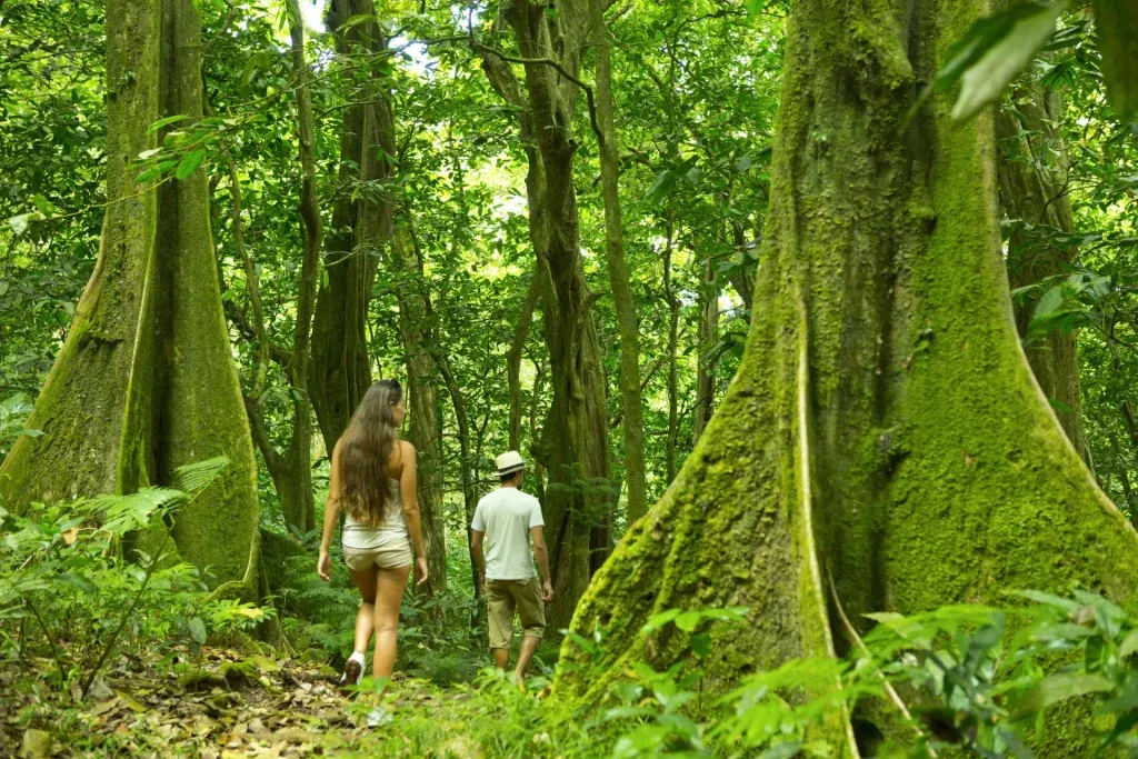
Polynesia is known for its idyllic beaches, but it also boasts numerous hiking trails with breathtaking views.

If you want to explore the lush interior of the islands of Tahiti and Moorea, here are a few tips to keep in mind before lacing up your sneakers and setting off on your adventure.

Attention!

ALWAYS CHECK

  • If access is private
  • If a guide is required
  • If the weather is safe
  • If you’re allowed to go alone

What should you pack in your backpack?

  • Water: bring at least 2 liters of water per person.
  • Snacks: bring energy-boosting snacks (dried fruit, bananas, etc.).
  • Biodegradable sunscreen and mosquito repellent.
  • First aid kit with a survival blanket.
  • A moripata* lamp.
  • A cell phone with your itinerary downloaded and a spare battery.

A few rules before heading out

  • Check the weather forecast first - especially during the rainy season, when trails can become dangerous due to rising rivers or landslides. Look at the forecast the day before, but be sure to check again the same day, as weather conditions can change quickly in Polynesia.
  • Start your hike early to avoid being caught out after dark.
  • Prepare yourself physically, as some hikes can be long and demanding. It’s important to know your fitness level - and that of your companions - before setting off.
  • Always let someone know your route and estimated return time, especially if you’re hiking alone. If you’re a beginner, avoid solo hikes altogether.
  • If your hike takes you near a marae (sacred site), do not touch or move any stones - these are sacred places and must be respected.
  • Most land, even in the mountains, is privately owned. Landowners usually allow hikers to pass as long as they are respectful and ask for permission. Sometimes a small access fee is required - and sneaking in is very frowned upon.
  • Leave no trace and always take your trash with you.
  • Respect the local wildlife and plant life. Use natural products - especially sunscreen - if you plan to swim in rivers.
  • Do not pick fruits or wild plants - they always belong to someone.
  • Tahiti
  • Moorea

Discover Tahiti’s hiking trails now, but please note that some require guides.

  • With guide
  • Without guide

Focus on Guided Hikes in Tahiti

19 - Le Diadème - Difficult level

  • Total duration: 6h
  • Total distance: 12.59 km
  • Elevation gain: 831 m

This hike requires an early departure, but the views over the valleys and waterfalls make it all worthwhile. It’s a beautiful trek that will take you up to 600 meters above sea level at the Toevere Pass. From there, you’ll enjoy a unique panorama over the island’s interior, featuring the famous Diadème summit. This pass was once used by the French army to outflank the Fort of Fachoda. You’ll also pass by the Fautaua waterfall viewpoint and explore the ruins of the Fachoda fort and the former governor’s gardens.

20 - Mount Aorai - Very difficult level

  • Total duration: 12h
  • Total distance: 18 km
  • Elevation gain: 1500 m
  • View the route

A magnificent hike to the island’s third-highest peak, which reaches 2066 meters. The trail starts near the O’Belvédère restaurant, perched at 600 meters and accessible by road from the Pirae town hall. You’ll need to start around 5 a.m. The ascent to the first hut (1400 m) takes about 2 hours. The trail to the second hut (1800 m) is more technical and includes rope sections. It takes another hour to reach the second hut.

21 - Plateau des Orangers - Difficult level

  • Total duration: 1 day
  • Total distance: 15 km
  • Elevation gain: 950 m
  • View the route

Head to the back of the Punaruu industrial area and continue along the road keeping the river on your right. The path becomes increasingly rough. Pass the houses until you reach a blue gate where you can park. Access to Regude and the plateau requires permission (around 1000 XPF per person), which can be obtained from the Orange Bearers Association of the valley. Phone: 87 20 04 15. The valley is open to the public only one month a year during the orange season. Check with the association or the Punaauia town hall.

Focus on self-guided hikes in Tahiti

1 - Vaipahi Water Gardens - Easy level

Located in Mataiea PK 49. This is a relatively short and easy hike that lets you admire many plant species and reach a first waterfall near a sacred historical site known for its purifying spring water. The place is filled with legends and a mystical atmosphere.

2 - Mille Sources - Easy level

Located in Mahina, at the top of the Mahinarama subdivision. The trail is well marked with a steady, gentle ascent. You must request access in advance from the local water authority (near Venus Point Elementary School) to get the gate code.

3 - Titaviri Valley - Easy level

Located in Papeari, starting from the sports complex. After 4-5 km, you’ll reach the King’s Pool, with picnic tables for a well-deserved break. Adventurous hikers can continue for an additional 10 km to reach the final water catchment, which resembles a rice terrace.

4 - Maroto Waterfall - Easy level

Located in Papenoo, this hike leads to a beautiful waterfall in the heart of Tahiti’s interior. To reach the trailhead, you’ll need a 4×4 vehicle. Go past small bungalows to the Fare Hape site, and park just before the marae. Follow the path for about 1 km to a line of trees on the right side of the road. Then turn right to find the trail that descends to the river. Cross at the fork, climb up the right branch, and you’ll reach the Maroto waterfall.

5 - Vaitavere - Intermediate level

Located in Punaauia, this hike is known for its steep incline. The path is well marked, making it easy to follow despite the difficulty. It requires good physical condition, but the stunning views are well worth the effort.

6 - Mount Marau - Intermediate level

Located in Punaauia, at the top of the Miri subdivision, next to a reservoir. The trail is easy to follow, with no technical difficulty until the final section. A 4×4 vehicle can take you up to the TV antenna at 1,441 meters to shorten the hike. Along the way, you’ll discover beautiful flora, including orchids and tree ferns. The hike offers stunning panoramas over the Plateau des Orangers, Diadème, Mount Orohena, and Mount Aorai.

7 - Tipaerui Waterfall - Intermediate level

  • Duration: 3h
  • Distance: 12 km
  • Elevation gain: 200 m - mostly along the riverbed
  • View the route

Located in Papeete. Be careful with the weather. The hike begins at the back of the Tipaerui industrial valley. You can park after crossing a small bridge. Bring a can of food - it’s required to enter and must be donated to the Tipaerui Valley Association, which helps preserve the site.

8 - Pic Vert - Intermediate level

Located in Papeete, this hike is considered fairly challenging. Head toward the Pic Vert residential area by turning left at Plastiserd, 1.2 km from the Tipaerui valley entrance. Follow the « Pic Vert » signs and park near the residence gate. The hike starts just to the left of the water tank.

9 - Mara’a Ridges - Intermediate level

Park near the Maraa caves. The trail begins at a concrete staircase along the road toward Taravao. The steep ascent includes several rope-assisted sections (be cautious if it has rained recently). After about 30 minutes, you’ll reach a fantastic viewpoint over the lagoon. The trail continues along the ridges before descending to a river. It is generally well marked with ribbons.

10 - Mission - Intermediate level

  • Duration: 3h30
  • Distance: 9.5 km
  • Elevation gain: 600 m, uneven and rugged terrain
  • View the route

From a distance, you can spot the large white cross lit up at night on the heights of Papeete. Park near the end of the Pureora access road. It takes 15 minutes to reach the cross and enjoy views over Papeete and Moorea. Then take the rosary path to the right - you’ll have two options that lead to the ridge. At the summit, a chapel awaits for a peaceful break.

11 - Fautaua Valley - Intermediate level

Located in Papeete. This trail includes steep sections with ropes. Be cautious with weather conditions. You must request access at Papeete City Hall. Fees: 600 XPF for adults, 150 XPF for children, and free for under 12s. You’ll find beautiful natural pools for a refreshing dip along the way.

12 - Old Mahinarama Road - Intermediate level

  • Total duration: 1h30 for the loop, 3h round-trip to the antennas
  • View the route

A pleasant and easy trail. Start at the first left-hand bend on the climb to Atima and leave your car there. The trail begins as a single track. You can continue along the main road or take a steeper trail with a rope on the right to reach the Mahinarama antennas.

13 - Basalt Organ Pipes - Intermediate level

  • Total duration: 6h round trip
  • Total distance: 9.78 km
  • Elevation gain: 848 m
  • View the route

Located in Mahina. After the Champion supermarket (from Papeete toward Mahina), take the road on the right after the bridge, where there’s a shop at the entrance. Drive all the way to the end of the access road - there’s a designated parking lot with about 15 spaces. Bring mosquito repellent and beware of fire ants. The trail is well-marked with multiple river crossings.

14 - Onohea - Intermediate level

  • Total duration: 4h30
  • Total distance: 10 km
  • Elevation gain: 450 m
  • View the route

Located in Tiarei, on the right just before the Onohea bridge. This is a river hike with numerous crossings. The trail can be unclear at times, so it’s easier to follow with a GPS track (try Organic Maps). A steep section leads to a double waterfall. Watch out for weather conditions.

15 - Fara’ura - Very difficult level

Located in Hiti’a, this demanding hike involves multiple river crossings and steep sections with ropes to access the waterfalls. You’ll walk past cultivated fields, along rivers, and approach the giant rock of the fiery Queen Teura before reaching Tapatea Falls. The highlight is the Fara’ura waterfall, plunging 180 meters into natural pools. Be sure to check weather conditions.

16 - Belvédère - Easy level

Located in Pirae, this accessible hike leads to a beautiful panoramic viewpoint over the city of Papeete and the island of Moorea in the distance. It’s also one of the island’s best paragliding spots. At the top, you can turn back, continue hiking toward Mount Aorai (alt. 2066 m), or grab a bite at the O’Belvédère restaurant.

17 - The 3 Waterfalls - Easy level

Located in Tiarei, the three Fararumai waterfalls can each be reached via short trails - just about a 10-minute walk. You’ll find beautiful trees, informative signs, and local fruit vendors in the parking area.

18 - East Coast Trail, Taiarapu Peninsula - Easy level

In Taravao, take the road toward Tautira. Just before the village, across from the sports center, turn right and park near the waterfront. From the parking lot, follow the trail that hugs the coast. The path crosses three rivers, including the Vaitoto, which has a strong current. On the mountain side, you’ll pass under Mount Tete and Tapioi.

Discover the hiking trails of Moorea now - please note that some absolutely require a guide.

  • Avec guide
  • Sans guide

Focus on Guided Hikes in Tahiti

11 - Mou’a Puta, the Pierced Mountain - Difficult level

  • Total duration (round trip): 4h
  • Total distance: 3 km
  • Elevation gain: 543 m

Take the access road (servitude) 200 meters after the Afareaitu pharmacy coming from Vai’are. You can drive partway up the track and park just before its end. It may be easier to park at the beginning of the access road and walk up.

12 - Mount Tohiea - Difficult level

  • Total duration (round trip): 4h
  • Total distance: 3 km
  • Elevation gain: 1089 m

You can park at the end of the valley near the water intake point (dirt road) where the GPS track begins. The first viewpoint is at 450 meters altitude, once you reach the ridge. The trail then dips slightly before ascending steadily (for over an hour) until reaching the ridge again with more viewpoints. The path is mostly steep and shaded by dense vegetation. Avoid if there has been recent rain, as it can be very slippery. Many rope-assisted sections.

The summit (1207 m) probably offers an incredible view over the caldera, but we didn’t get to enjoy it due to the clouds.

13 - Mount Rotui - Very difficult level

  • Total duration (round trip): 7 hours
  • Total distance: 6.9 km
  • Elevation gain: 901 m
  • View the route

The trailhead is located just past the Hilton Hotel, marked by a sign on the left after the first coconut tree. The ascent takes about 3.5 hours, starting in the shade for the first half and then fully exposed to the sun. The second part of the hike follows the ridge with steep and narrow sections to climb. The summit is at 900 meters altitude.

Focus on Self-Guided Hikes in Tahiti

1 - Magic Mountain - Easy level

  • Total duration (round trip): 1h
  • Total distance: 3.3 km
  • Elevation gain: 180 m
  • View the route

Paved road followed by a well-maintained trail. Easy hike starting in Opunohu Bay next to the Fare Tutava, which sells jams. There is a parking lot on the mountain side with a hut and a sign indicating the starting point. Entrance fee: 200 XPF, payable at the hut.

2 - Pineapple Route - Easy level

  • Total duration (round trip): 1h38
  • Total distance: 5 km
  • Elevation gain: 45 m
  • View the route

Loop hike near Pao Pao, considered an easy trail and a popular spot for running.

3 - Temae Ridge - Easy level

  • Total duration (round trip): 15 min
  • Total distance: 2 km
  • Elevation gain: 305 m

Start at the parking lot of the Temae OPT office. You can climb on the right under the mango trees to reach the steps leading to the antenna. The trail is clearly visible after that. Bring sun protection, as the trail is very exposed.

4 - Educational trails around the Opunohu Agricultural School - Easy level

  • Total duration (round trip): 1h30

Trail created by students to explore the heart of the farm. You’ll see vegetable gardens, citrus orchards, pineapples, papayas, and flowers. It’s a great opportunity to learn about agriculture, pig farming, and the production and sale of homemade products (jams, fruit pastes, juices). Open Monday to Friday 8 a.m. - 4 p.m. and Saturday 8 a.m. - 12:15 p.m. Accessible on foot, by mountain bike, pickup, or quad.

5 - Three Coconut Trees - Moderate level

  • Total duration (round trip): 3h
  • Total distance: 7 km
  • Elevation gain: 292 m
  • View the route

In the Opunohu Valley, follow the road inland near the CRIOVE. This road also leads to the agricultural school and the viewpoint with incredible views over Opunohu Bay (left) and Cook’s Bay (right), and Mount Rotui in between. From the viewpoint parking lot, the trail for the Three Coconut Trees starts at the back right. Well-marked trail with info signs. Steep climb to the viewpoint.

6 - Three Pine Trees - Easy level

  • Total duration (round trip): 1h30
  • Total distance: 3.5 km
  • Elevation gain: 200 m
  • View the route

In the Opunohu Valley, follow the inland road at CRIOVE. Same access as for the viewpoint and agricultural school. From the parking lot, the trail for Three Pine Trees starts at the back left. Well-marked trail with info signs. Duration: 1h30 round trip.

7 - Vaiare Pass - Easy level

  • Total duration (round trip): 3h30
  • Total distance: 9.6 km
  • Elevation gain: 300 m (from the viewpoint) / 550 m (from the port)
  • View the route

Total duration: 1h if starting from the back of the bay, 200 m from the ferry near Bayside Moorea Market. Follow the trail under the CJA and up through orchards. Cross a river, then ascend steeply through the forest. At the pass, go right to reach the viewpoint or left to connect to Three Pine Trees, the Viewpoint, or Three Coconut Trees trails.

8 - Putoa Waterfalls - Easy level

  • Total duration (round trip): 50 min (1st fall) / 1h20 (2nd fall)
  • Total distance: 1.9 km (to first fall) / 2.8 km (to second fall)
  • Elevation gain: 160 m (1st fall) / 175 m (2nd fall)
  • View the route

Located in Afareaitu, with two waterfalls: Atiraa and Vaioro. The starting point is at the end of the trail past Afareaitu College.

9 - Vaioro Waterfall - Easy level

  • Total duration (round trip): 1h30
  • Total distance: 4.3 km
  • Elevation gain: 120 m
  • View the route

Located in Afareaitu. This waterfall is at the start of the trail leading to the pierced mountain: Mount Mou’a Puta.

10 - Table of Maatea - Moderate level

  • Total duration (round trip): 3h
  • Total distance: 7 km
  • Elevation gain: 300 m
  • View the route

Take the first right after ALAM store from Vaiare, then turn left past the soccer field and park before the bridge. After about 3 km, take the left-hand trail. A lovely family hike with fruit trees like bananas, oranges, and papayas to admire along the way.

Written by Maeva Lautret

Checked July 2026

You reached the end
Mark it read and it joins what you have read.

Read next

Welcome to Anoe - Maeva!

Anoe just launched - every day we're adding more local guides and activities across the islands. There might be from time to time some technical hick-up, please apologize. If anything doesn't feel right, write to us at team@anoe.app - we'd love to hear from you.